2017
SK3084 : Path Junction in the Mayfield Valley, Sheffield
taken 7 years ago, near to Fulwood, Sheffield, England
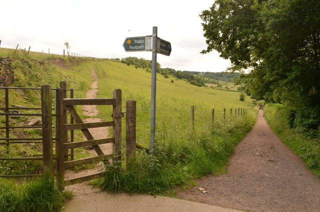
Path Junction in the Mayfield Valley, Sheffield
Sheffield City Council public footpath signs in the Mayfield Valley, near Forge Dam in the southwest of the city. The footpath to the right follows the valley and leads in a mile or so to the Peak District National Park.
 Map © Crown Copyright")
TIP: Click the map for more Large scale mapping
- Grid Square
- SK3084, 99 images (more nearby 🔍)
- Photographer
- Andrew Tryon (more nearby)
- Date Taken
- Tuesday, 13 June, 2017 (more nearby)
- Submitted
- Sunday, 25 June, 2017
- Subject Location
-
OSGB36:
 SK 3032 8487 [10m precision]
WGS84: 53:21.5906N 1:32.7531W - Camera Location
-
OSGB36: SK 3034 8489
- View Direction
- Southwest (about 225 degrees)