2017
TA0928 : Hull, Trinity House
taken 7 years ago, near to Kingston Upon Hull, England
This is 1 of 170 images, with title starting with Hull in this square
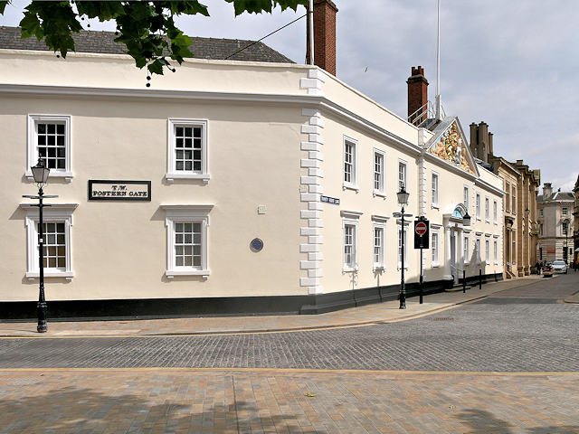
Hull, Trinity House
The Hull Trinity House, locally known as Trinity House, was formally established in 1369 as a religious guild providing support and almshouses for the needy. In 1456, the guild became purely a seamens guild, concerned with maritime affairs. Under a 1581 charter the guild regulated the use of The Haven (later the Old harbour), and licensed pilots. It also positioned buoys and beacons in the Humber for navigation. By the 18th century it had responsibilities including management of the harbour at Hull, and buoys and pilotage in the Humber estuary. The Trinity House Building was rebuilt in 1753 and a guild house added in 1775. It is a Grade I listed building (List entry Number: 1219563 Link Historic England).
See also TA0928 : Trinity House Pediment
See also TA0928 : Trinity House Pediment
 Map © Crown Copyright")
TIP: Click the map for more Large scale mapping
- Grid Square
- TA0928, 6575 images (more nearby 🔍)
- Photographer
- David Dixon (more nearby)
- Date Taken
- Monday, 3 July, 2017 (more nearby)
- Submitted
- Monday, 10 July, 2017
- Subject Location
-
OSGB36:
 TA 098 286 [100m precision]
WGS84: 53:44.5326N 0:20.1267W - Camera Location
-
OSGB36: TA 098 285
- View Direction
- NORTH (about 0 degrees)