2017
TA1028 : Hull Tidal Surge Barrier
taken 7 years ago, near to Kingston Upon Hull, England
This is 1 of 4 images, with title Hull Tidal Surge Barrier in this square
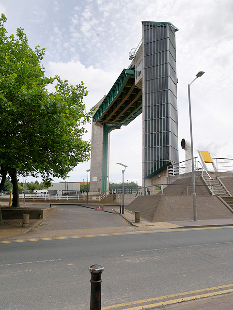
Hull Tidal Surge Barrier
Since 1980, the mouth of the River Hull has been protected by a tidal barrier at the estuary, which can be closed to prevent tidal surges entering the river system and causing flooding upriver.
 Map © Crown Copyright")
TIP: Click the map for more Large scale mapping
- Grid Square
- TA1028, 3428 images (more nearby 🔍)
- Photographer
- David Dixon (more nearby)
- Date Taken
- Monday, 3 July, 2017 (more nearby)
- Submitted
- Monday, 10 July, 2017
- Subject Location
-
OSGB36:
 TA 101 283 [100m precision]
WGS84: 53:44.3995N 0:19.8681W - Camera Location
-
OSGB36: TA 101 283
- View Direction
- East-northeast (about 67 degrees)