2017
TA0223 : The Southern End of the Humber Bridge
taken 7 years ago, near to Humber Bridge, East Riding of Yorkshire, England
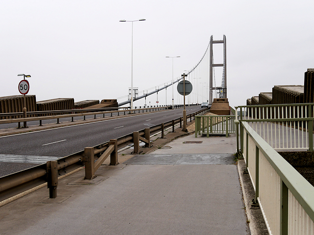
The Southern End of the Humber Bridge
The Humber Bridge spans the Humber Estuary between Barton-upon-Humber on the south bank and Hessle on the north bank, connecting the East Riding of Yorkshire and North Lincolnshire. It is a 2,220-metre (7,280 ft) single-span suspension bridge with the north tower sited on the high water line and the south tower founded in shallow water 500m from the shore. The bridge opened to traffic on 24 June 1981; at that time, it was the longest of its type in the world, a record it held for seventeen years until it was surpassed in 1998; it is the eighth-longest. Its central span of 1,410 metres (4,626 ft) means that it still has the longest suspended central span in Britain (Link Engineering Timelines).
The opening of the bridge reduced the road-distance between Hull and Grimsby by nearly 50 miles and it is now used by more than 8 million road vehicles per year (Link Humber Bridge Board). Current (2017) toll charges range from £1.50 per crossing for cars up to £12 per crossing for large goods vehicles. Pedestrians, cyclists and motorcyclists may cross the bridge free of charge (Link Humber Bridge Board Toll Charges).
See other images of The Humber Bridge
The opening of the bridge reduced the road-distance between Hull and Grimsby by nearly 50 miles and it is now used by more than 8 million road vehicles per year (Link
See other images of The Humber Bridge
 Map © Crown Copyright")
TIP: Click the map for more Large scale mapping
- Grid Square
- TA0223, 582 images (more nearby 🔍)
- Photographer
- David Dixon (more nearby)
- Date Taken
- Tuesday, 4 July, 2017 (more nearby)
- Submitted
- Wednesday, 12 July, 2017
- Subject Location
-
OSGB36:
 TA 025 233 [100m precision]
WGS84: 53:41.8032N 0:26.9416W - Camera Location
-
OSGB36: TA 025 232
- View Direction
- NORTH (about 0 degrees)