2017
NT2826 : Douglas Burn below Whitehope Rig
taken 7 years ago, near to Dryhope, Scottish Borders, Scotland
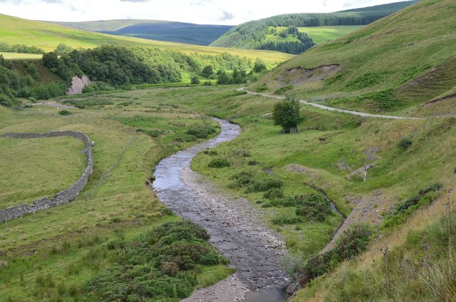
Douglas Burn below Whitehope Rig
The Whitehope Burn joins from the right. The small clump of trees R of centre is shown in close-up in NT2826 : "The Heart of the Ettrick Forest".
 Map © Crown Copyright")
TIP: Click the map for more Large scale mapping
- Grid Square
- NT2826, 16 images (more nearby 🔍)
- Photographer
- Jim Barton (more nearby)
- Date Taken
- Wednesday, 12 July, 2017 (more nearby)
- Submitted
- Wednesday, 12 July, 2017
- Subject Location
-
OSGB36:
 NT 2819 2625 [10m precision]
WGS84: 55:31.4812N 3:8.3415W - Camera Location
-
OSGB36: NT 2825 2609
- View Direction
- North-northwest (about 337 degrees)