2017
SH2992 : Coast path waymarker and a view to The Skerries
taken 7 years ago, 3 km from Llanfairynghornwy, Isle of Anglesey/Sir Ynys Mon, Wales
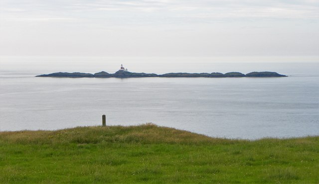
Coast path waymarker and a view to The Skerries
The coast path seems to be rather vague on the ground in the Carmel Head area, and the few waymarkers don't seem to indicate the walked path which must be nearer the shoreline. Some walking through lush grass, hopping over electric fences and through a huge herd of dairy cows eventually brought me to the old copper mine chimney further east.
 Map © Crown Copyright")
TIP: Click the map for more Large scale mapping
- Grid Square
- SH2992, 71 images (more nearby 🔍)
- Photographer
- Gordon Hatton (more nearby)
- Date Taken
- Thursday, 6 July, 2017 (more nearby)
- Submitted
- Thursday, 20 July, 2017
- Subject Location
-
OSGB36:
 SH 2915 9265 [10m precision]
WGS84: 53:24.1764N 4:34.2860W - Camera Location
-
OSGB36: SH 2918 9258
- View Direction
- North-northwest (about 337 degrees)