2002
SO8553 : Drained Diglis Basin
taken 21 years ago, near to Worcester, Worcestershire, England
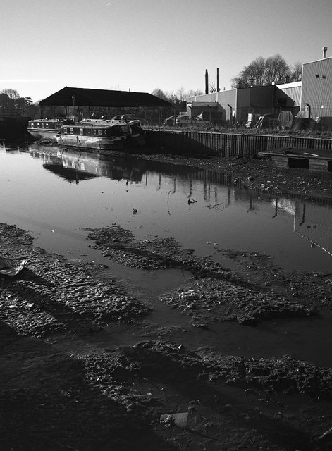
Drained Diglis Basin
Narrowboats grounded whilst Diglis Basin at Worcester has been drained. Since this picture was taking all the former industrial buildings on the right have been demolished and the site redeveloped with residential apartments.
 Map © Crown Copyright")
TIP: Click the map for more Large scale mapping
- Grid Square
- SO8553, 218 images (more nearby 🔍)
- Photographer
- Philip Halling (more nearby)
- Date Taken
- December 2002 (more nearby)
- Submitted
- Friday, 21 July, 2017
- Subject Location
-
OSGB36:
 SO 8500 5395 [10m precision]
WGS84: 52:11.0155N 2:13.2485W - Camera Location
-
OSGB36: SO 8504 5397
- View Direction
- West-southwest (about 247 degrees)