SO9233 : Rusty railway line past the east side of Ashchurch railway station
taken 7 years ago, near to Ashchurch, Gloucestershire, England
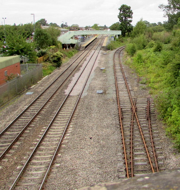
The footbridge and two platforms at Ashchurch for Tewkesbury railway station are ahead.
Viewed from the A46 bridge. Link
Scenes over the years 1946 to present day taken at or near Ashchurch Station, which was the junction for Evesham and Birmingham via Redditch and Barnt Green (closed for passengers June 1963 (Goods July 1964), to Redditch) and for Tewkesbury and Great Malvern (closed beyond Upton-on-Severn in December 1952, to Upton in July 1963 (passengers August 1961), finally Goods to Tewkesbury in November 1964; the loop connecting the Evesham line with the Tewkesbury line, which crossed the Birmingham - Bristol main line at the north end of the station, was closed in May 1957. A siding into the MoD Depot at Ashchurch, formerly off the Evesham line, remains.
Ashchurch Station and the branch to Tewkesbury date back to 1840 (Birmingham & Gloucester, later Midland Railway. It was closed in November 1971, but a completely new station, 'Ashchurch for Tewkesbury', was opened in May 1997.
 Map © Crown Copyright")
- Grid Square
- SO9233, 292 images (more nearby 🔍)
- Photographer
- Jaggery (more nearby)
- Date Taken
- Saturday, 29 July, 2017 (more nearby)
- Submitted
- Monday, 31 July, 2017
- Subject Location
-
OSGB36:
 SO 9265 3340 [10m precision]
WGS84: 51:59.9396N 2:6.5081W - Camera Location
-
OSGB36: SO 9264 3325
- View Direction
- NORTH (about 0 degrees)