2017
TA1128 : Humber Estuary
taken 7 years ago, near to Kingston Upon Hull, England
This is 1 of 124 images, with title Humber Estuary in this square
Humber Estuary
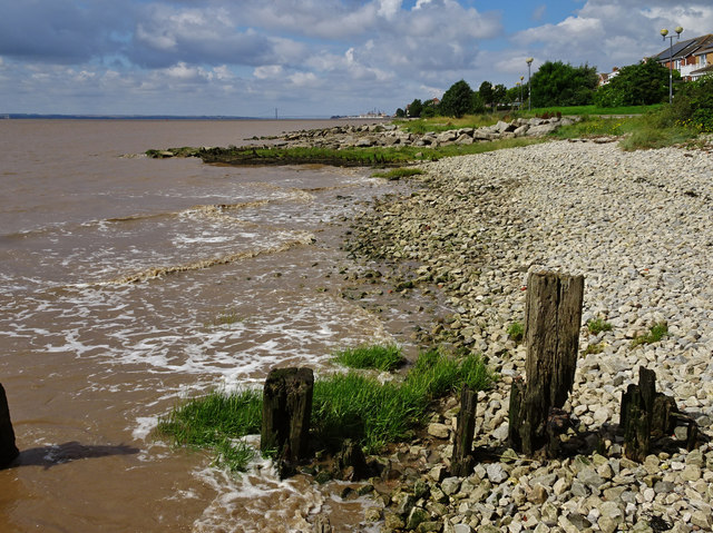
The incoming tide on the Humber foreshore adjacent to the Victoria Dock Village. The south pier of the Humber Bridge can just be seen on the horizon.
 Map © Crown Copyright")
TIP: Click the map for more Large scale mapping
- Grid Square
- TA1128, 507 images (more nearby 🔍)
- Photographer
- Bernard Sharp (more nearby)
- Date Taken
- Sunday, 30 July, 2017 (more nearby)
- Submitted
- Monday, 31 July, 2017
- Subject Location
-
OSGB36:
 TA 1156 2859 [10m precision]
WGS84: 53:44.5058N 0:18.5993W - Camera Location
-
OSGB36: TA 1159 2860
- View Direction
- West-southwest (about 247 degrees)