2017
SK5480 : View Towards Hatfield Farm and Shireoaks Church
taken 7 years ago, near to Shireoaks, Nottinghamshire, England
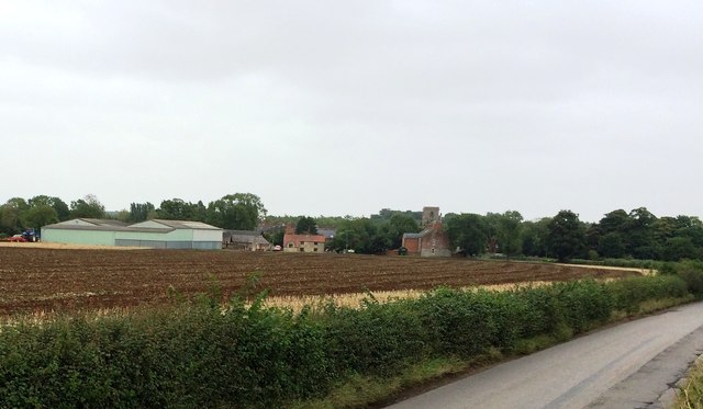
View Towards Hatfield Farm and Shireoaks Church
Pictured from Thorpe Lane at the eastern edge of the square. The village dwellings and church are in SK5580.
 Map © Crown Copyright")
TIP: Click the map for more Large scale mapping
- Grid Square
- SK5480, 18 images (more nearby 🔍)
- Photographer
- Jonathan Clitheroe (more nearby)
- Date Taken
- Wednesday, 2 August, 2017 (more nearby)
- Submitted
- Thursday, 3 August, 2017
- Subject Location
-
OSGB36:
 SK 5499 8080 [10m precision]
WGS84: 53:19.2767N 1:10.5564W - Camera Location
-
OSGB36: SK 5493 8079
- View Direction
- East-northeast (about 67 degrees)