2017
TQ8897 : Saltings, Bridgemarsh Creek
taken 7 years ago, 3 km from Althorne, Essex, England
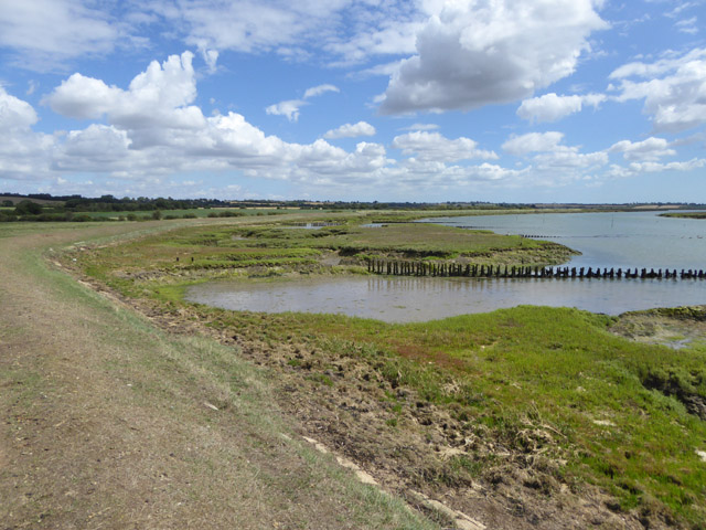
Saltings, Bridgemarsh Creek
Visible is one of the several groynes along here, formed from wooden stakes.
 Map © Crown Copyright")
TIP: Click the map for more Large scale mapping
- Grid Square
- TQ8897, 12 images (more nearby 🔍)
- Photographer
- Robin Webster (more nearby)
- Date Taken
- Friday, 4 August, 2017 (more nearby)
- Submitted
- Friday, 4 August, 2017
- Subject Location
-
OSGB36:
 TQ 8894 9731 [10m precision]
WGS84: 51:38.5706N 0:43.7569E - Camera Location
-
OSGB36: TQ 88814 97272
- View Direction
- East-northeast (about 67 degrees)