2017
SK1966 : View Over Lathkill Dale
taken 7 years ago, near to Over Haddon, Derbyshire, England
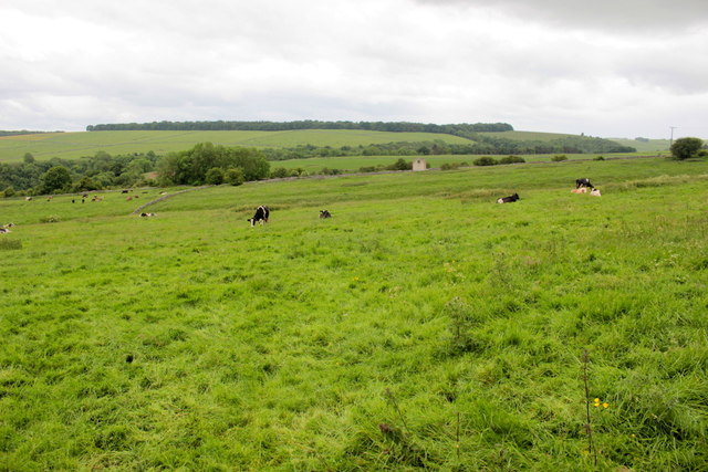
View Over Lathkill Dale
Lathkill Dale is marked by the swathe of dark trees winding across the middle of the image. Beyond it on the skyline is Bee Low Woods. The local fields are all pasture , this one with cattle on it.
 Map © Crown Copyright")
TIP: Click the map for more Large scale mapping
- Grid Square
- SK1966, 41 images (more nearby 🔍)
- Photographer
- Nigel Mykura (more nearby)
- Date Taken
- Saturday, 10 June, 2017 (more nearby)
- Submitted
- Saturday, 5 August, 2017
- Subject Location
-
OSGB36:
 SK 192 662 [100m precision]
WGS84: 53:11.5578N 1:42.7734W - Camera Location
-
OSGB36: SK 194 665
- View Direction
- South-southwest (about 202 degrees)