2017
NS2874 : Burn flowing from a water shaft
taken 7 years ago, near to Greenock, Inverclyde, Scotland
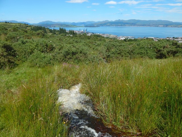
Burn flowing from a water shaft
As shown in NS2874 : Water shaft, and on the 1:25000 map, water issues from the base of a nearby NS2874 : Water shaft. It flows beneath a path, and re-emerges on the other side, as shown here.
The twists of the burn's course make it impractical to show more than a short section of it, but the current is vigorous, as the picture reveals.
The twists of the burn's course make it impractical to show more than a short section of it, but the current is vigorous, as the picture reveals.
 Map © Crown Copyright")
TIP: Click the map for more Large scale mapping
- Grid Square
- NS2874, 67 images (more nearby 🔍)
- Photographer
- Lairich Rig (more nearby)
- Date Taken
- Monday, 24 July, 2017 (more nearby)
- Submitted
- Sunday, 6 August, 2017
- Subject Location
-
OSGB36:
 NS 2844 7431 [10m precision]
WGS84: 55:55.8693N 4:44.8671W - Camera Location
-
OSGB36: NS 2844 7430
- View Direction
- Northwest (about 315 degrees)