2017
SK4438 : Footpath waymark
taken 7 years ago, near to Dale Abbey, Derbyshire, England
This is 1 of 2 images, with title starting with Footpath in this square
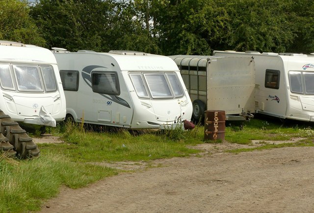
Footpath waymark
The caravans hide the official waymark where the path passes through the hedge behind, so this makeshift has been installed by the farmer to deter walkers from passing through private property.
 Map © Crown Copyright")
TIP: Click the map for more Large scale mapping
- Grid Square
- SK4438, 27 images (more nearby 🔍)
- Photographer
- Alan Murray-Rust (more nearby)
- Date Taken
- Sunday, 6 August, 2017 (more nearby)
- Submitted
- Wednesday, 9 August, 2017
- Subject Location
-
OSGB36:
 SK 4432 3809 [10m precision]
WGS84: 52:56.3030N 1:20.5198W - Camera Location
-
OSGB36: SK 4431 3809
- View Direction
- East-northeast (about 67 degrees)