2017
ST5060 : Blagdon reservoir road
taken 7 years ago, near to Blagdon, North Somerset, England
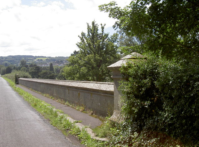
Blagdon reservoir road
The lake (man-made in the early 1900s) hold 8,456 megalitres of water for public consumption. The road marks the western end and to the right of the wall is the Byewash. The pillar nearest the camera has a benchmark - see ST5060 : Benchmark under the ivy.
 Map © Crown Copyright")
TIP: Click the map for more Large scale mapping
- Grid Square
- ST5060, 59 images (more nearby 🔍)
- Photographer
- Neil Owen (more nearby)
- Date Taken
- Tuesday, 15 August, 2017 (more nearby)
- Submitted
- Thursday, 17 August, 2017
- Subject Location
-
OSGB36:
 ST 5042 6029 [10m precision]
WGS84: 51:20.3714N 2:42.7890W - Camera Location
-
OSGB36: ST 5042 6030
- View Direction
- South-southwest (about 202 degrees)