2017
TG3105 : A field of beans east of Mill Road
taken 7 years ago, near to Surlingham, Norfolk, England
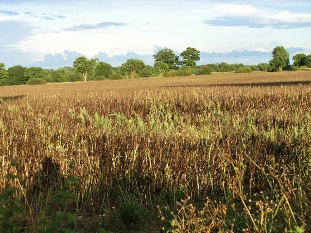
A field of beans east of Mill Road
Beans are legumes - a crop that is able to make use of atmospheric nitrogen to enrich the protein content of both the plant and seed. This is achieved by utilising bacteria that inhabit nodules in the roots of the plant - when the roots decay, the nitrogen becomes available to the following crop as a fertiliser. Beans grown in the UK are known as field beans. Many farmers choose not to precision drill the crops but to simply broadcast the beans with a fertiliser spreader and then plough the bean under, hence the often observed irregular distribution of the plants. Typically, beans contain twice the protein content of cereal crops like wheat - a factor that has contributed to their continued use in the UK over the last 3000 years. The national bean crop typically covers between 110 and 170,000 hectares each year and average yields for the UK crop are around 3.75 tonnes per hectare . Most of the bean crop is grown for stock feed and is used as a locally grown GM free alternative to protein crops like soya. The major human consumption market for beans is the Middle East where beans are used prior to the Ramadan fasting period.
 Map © Crown Copyright")
TIP: Click the map for more Large scale mapping
- Grid Square
- TG3105, 144 images (more nearby 🔍)
- Photographer
- Evelyn Simak (more nearby)
- Date Taken
- Friday, 18 August, 2017 (more nearby)
- Submitted
- Friday, 18 August, 2017
- Subject Location
-
OSGB36:
 TG 3193 0569 [10m precision]
WGS84: 52:35.9679N 1:25.4005E - Camera Location
-
OSGB36: TG 3169 0571
- View Direction
- EAST (about 90 degrees)