2017
SE0563 : Approaching Dibble's Bridge
taken 7 years ago, near to Hebden, North Yorkshire, England
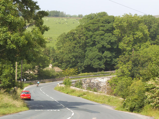
Approaching Dibble's Bridge
A lone cyclist rounds the bend with care at the bottom of a long descent. See SE0563 : Dibbles Bridge for a side view of the bridge, and the history of its name.
B6265 Road (North Yorkshire)
The B6265 is a long-way-round B-road in north Yorkshire, connecting the A59 with itself via the Yorkshire Dales. It runs 45 miles from Skipton to Green Hammerton via Grassington, Pateley Bridge, Ripon and Boroughbridge.
Link
 Map © Crown Copyright")
TIP: Click the map for more Large scale mapping
- Grid Square
- SE0563, 63 images (more nearby 🔍)
- Photographer
- Stephen Craven (more nearby)
- Date Taken
- Thursday, 6 July, 2017 (more nearby)
- Submitted
- Sunday, 20 August, 2017
- Subject Location
-
OSGB36:
 SE 0518 6303 [10m precision]
WGS84: 54:3.7914N 1:55.3410W - Camera Location
-
OSGB36: SE 0528 6304
- View Direction
- WEST (about 270 degrees)