2017
SJ9003 : Marsh Lane Narrows near Fordhouses, Wolverhampton
taken 7 years ago, near to Oxley, Wolverhampton, England
This is 1 of 3 images, with title Marsh Lane Narrows near Fordhouses, Wolverhampton in this square
Marsh Lane Narrows near Fordhouses, Wolverhampton
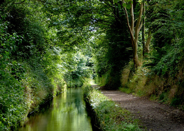
The Staffordshire and Worcestershire Canal, looking south-west towards Autherley Junction.
Marsh Lane narrows are about five hundred metres long, and are cut into the sandstone bedrock on the east side. There are two passing places; elsewhere narrowboats cannot pass each other.
Marsh Lane narrows are about five hundred metres long, and are cut into the sandstone bedrock on the east side. There are two passing places; elsewhere narrowboats cannot pass each other.
 Map © Crown Copyright")
TIP: Click the map for more Large scale mapping
- Grid Square
- SJ9003, 145 images (more nearby 🔍)
- Photographer
- Roger D Kidd (more nearby)
- Date Taken
- Saturday, 19 August, 2017 (more nearby)
- Submitted
- Sunday, 27 August, 2017
- Subject Location
-
OSGB36:
 SJ 9071 0331 [10m precision]
WGS84: 52:37.6480N 2:8.3208W - Camera Location
-
OSGB36: SJ 9074 0336
- View Direction
- South-southwest (about 202 degrees)