2017
SO2676 : Brynorgan and Selley Hall
taken 7 years ago, near to Purlogue, Shropshire, England
This is 1 of 2 images, with title Brynorgan and Selley Hall in this square
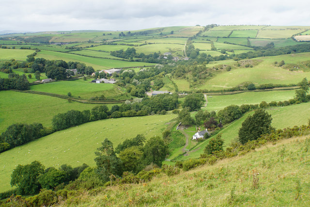
Brynorgan and Selley Hall
Looking northwards along the line of Offa's Dyke Path. The far hillside rises up towards Llanfair Hill.
 Map © Crown Copyright")
TIP: Click the map for more Large scale mapping
- Grid Square
- SO2676, 27 images (more nearby 🔍)
- Photographer
- Bill Boaden (more nearby)
- Date Taken
- Saturday, 19 August, 2017 (more nearby)
- Submitted
- Monday, 28 August, 2017
- Subject Location
-
OSGB36:
 SO 2678 7634 [10m precision]
WGS84: 52:22.8108N 3:4.6264W - Camera Location
-
OSGB36: SO 2692 7619
- View Direction
- Northwest (about 315 degrees)