2017
TV5198 : The lower Cuckmere valley
taken 7 years ago, near to Westdean, East Sussex, England
This is 1 of 5 images, with title The lower Cuckmere valley in this square
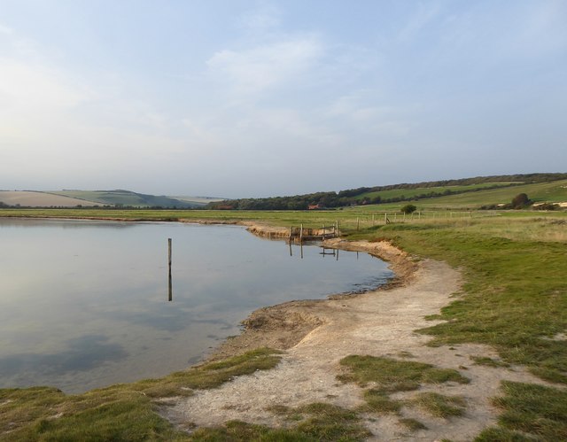
The lower Cuckmere valley
Looking inland from the shore of the old Cuckmere river, at the last easterly swing in the river's meandering course before it reaches the sea.
The wide flood-plain here is now grazing marsh, reclaimed over the centuries from salt marsh. According to Simon Carey - whose local knowledge is far greater than mine - proposals exist to re-open the area to the tides: Link A number of such 'managed re-alignment' or 'managed retreat' schemes have already been implemented - to my knowledge, at Freiston Shore in Lincolnshire, at Medmerry in West Sussex, at Wallasea Island in Essex, and at Egypt Bay on the Thames estuary.
In the picture, the distant hilltop to the left is at High and Over.
 Map © Crown Copyright")
TIP: Click the map for more Large scale mapping
- Grid Square
- TV5198, 360 images (more nearby 🔍)
- Photographer
- Stefan Czapski (more nearby)
- Date Taken
- Tuesday, 29 August, 2017 (more nearby)
- Submitted
- Friday, 1 September, 2017
- Subject Location
-
OSGB36:
 TV 5185 9893 [10m precision]
WGS84: 50:46.2052N 0:9.1254E - Camera Location
-
OSGB36: TV 5188 9877
- View Direction
- North-northwest (about 337 degrees)