TQ5283 : Ingrebourne Valley, near Rainham
taken 7 years ago, near to Rainham, Havering, England
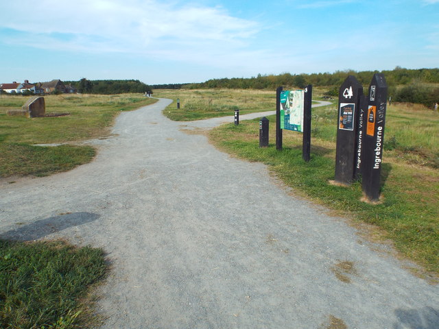
Ingrebourne Valley Local Nature Reserve is 240ha of river valley by the River Ingrebourne. Much of the area is composed of flooded gravel pits.
Website: Link
Hornchurch Country Park is on the former site of Hornchurch Airfield, in the London Borough of Havering.
The River Ingrebourne passes through the park and if forms part of Thames Chase Community Forest. The London Outer Orbital Path runs through the park. The most popular part of the park is to the west of the Ingrebourne, where the ground is flat and paved; this area is most commonly frequented by dog walkers. The woodland to the east of the river is somewhat inaccessible. Some southern parts of the park that reach into Rainham have been used as landfill.
There are a number of pillboxes and other items dating from the Second World War to be found in the park
Starting at the Thames at Erith and finishing on the opposite north bank at Coldharbour, the Loop (London Outer Orbital Path) is 150 miles long, passing through numerous woods, commons and parks and on waterside paths alongside the Grand Union Canal and London rivers such as the Colne, Crane, Cray, Darent and Ingrebourne.
The National Cycle Network is a network of cycle routes. It was created by the charity Sustrans Link
Many routes aim to minimise contact with motor traffic, though 70% of them are on roads. In some cases the NCN uses pedestrian routes, disused railways, minor roads, canal towpaths, or traffic-calmed routes in towns and cities.
 Map © Crown Copyright")
- Grid Square
- TQ5283, 53 images (more nearby 🔍)
- Photographer
- Malc McDonald (more nearby)
- Date Taken
- Monday, 28 August, 2017 (more nearby)
- Submitted
- Friday, 1 September, 2017
- Subject Location
-
OSGB36:
 TQ 5228 8309 [10m precision]
WGS84: 51:31.5717N 0:11.6253E - Camera Location
-
OSGB36: TQ 5228 8308
- View Direction
- North-northeast (about 22 degrees)