2005
SP2655 : Wellesbourne Mountford Airfield
taken 19 years ago, near to Charlecote, Warwickshire, England
This is 1 of 2 images, with title Wellesbourne Mountford Airfield in this square
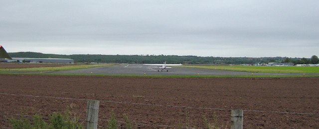
Wellesbourne Mountford Airfield
Built on farmland in 1941 the airfield was closed in 1965. It was licensed for flying training in 1981.
 Map © Crown Copyright")
TIP: Click the map for more Large scale mapping
- Grid Square
- SP2655, 39 images (more nearby 🔍)
- Photographer
- Janine Forbes (more nearby)
- Date Taken
- Sunday, 18 September, 2005 (more nearby)
- Submitted
- Monday, 19 September, 2005
- Subject Location
-
OSGB36:
 SP 263 552 [100m precision]
WGS84: 52:11.6649N 1:36.9996W - Camera Location
-
OSGB36: SP 2640 5555