2017
SN0406 : Cresswell River
taken 7 years ago, near to Cresswell Quay, Pembrokeshire/Sir Benfro, Wales
This is 1 of 4 images, with title Cresswell River in this square
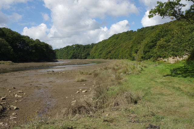
Cresswell River
The Cresswell River is one of many tidal creeks that branch off the Daugleddau, geographically a good example of a ria or drowned valley. This view is looking downstream at low tide.
 Map © Crown Copyright")
TIP: Click the map for more Large scale mapping
- Grid Square
- SN0406, 39 images (more nearby 🔍)
- Photographer
- Stephen McKay (more nearby)
- Date Taken
- Thursday, 31 August, 2017 (more nearby)
- Submitted
- Monday, 4 September, 2017
- Subject Location
-
OSGB36:
 SN 0479 0673 [10m precision]
WGS84: 51:43.5131N 4:49.6706W - Camera Location
-
OSGB36: SN 0487 0675
- View Direction
- West-southwest (about 247 degrees)