SU4667 : Kennet & Avon Canal, Newbury
taken 17 years ago, near to Newbury, West Berkshire, England
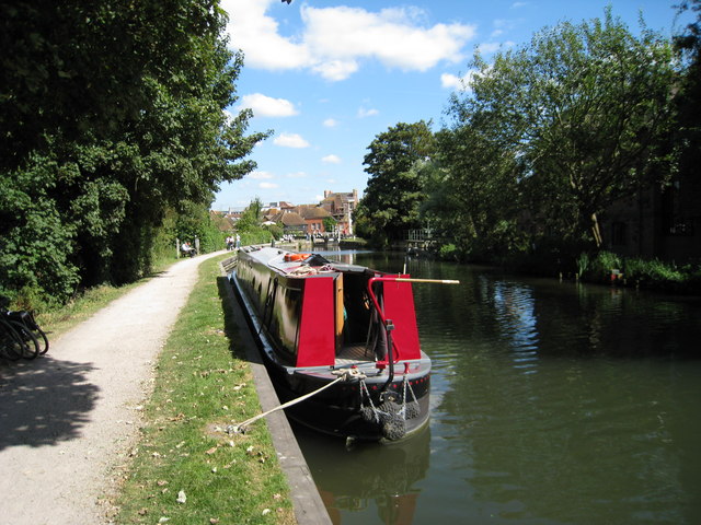
The Kennet and Avon is made up of two river navigations and a linking stretch of canal. It runs from Hanham Lock near Bristol to the River Thames at Reading, over 100 miles long with more than 100 locks, some magnificent engineering and crossing some of the most beautiful scenery in southern England. It was only reopened in 1990 after decades of dereliction.
A Narrowboat is a long thin boat, designed to fit the canals of England and Wales. They were 7 feet (2.1 metres) wide, and up to 70 feet (21 metres) in length, the maximum that will fit in a standard lock.
In the 18th century before the age of steam railways and the internal combustion engines, the canals were one of the key systems of transporting goods around the country. The boats were towed by a shire horse walking along the tow-path. Of course boats today are powered by diesel engines.
Most narrowboats today are used for holidays & leisure cruising, and some are used as homes.
Read more at wikipedia Link
 Map © Crown Copyright")
- Grid Square
- SU4667, 354 images (more nearby 🔍)
- Photographer
- Oast House Archive (more nearby)
- Date Taken
- Tuesday, 11 September, 2007 (more nearby)
- Submitted
- Tuesday, 11 September, 2007
- Subject Location
-
OSGB36:
 SU 469 671 [100m precision]
WGS84: 51:24.0706N 1:19.6057W - Camera Location
-
OSGB36: SU 469 671
- View Direction
- East-northeast (about 67 degrees)