2017
NY0614 : Forestry Commission access road
taken 7 years ago, near to Ennerdale Bridge, Cumbria, England
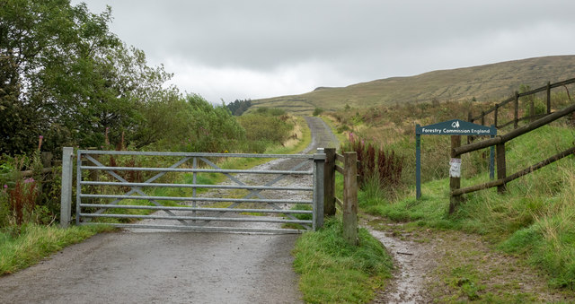
Forestry Commission access road
The road accesses Forestry Commission land to the east of Scarney Brow, south of the village of Ennerdale Bridge. The road heads towards plantations on the slopes of the hills, Grike and Crag Hill; much of the planting there has been harvested. Unusually perhaps, the access road sign doesn't declare the name of the forest into which the road travels.
 Map © Crown Copyright")
TIP: Click the map for more Large scale mapping
- Grid Square
- NY0614, 14 images (more nearby 🔍)
- Photographer
- Trevor Littlewood (more nearby)
- Date Taken
- Thursday, 7 September, 2017 (more nearby)
- Submitted
- Thursday, 7 September, 2017
- Subject Location
-
OSGB36:
 NY 0624 1441 [10m precision]
WGS84: 54:30.9770N 3:26.9921W - Camera Location
-
OSGB36: NY 0618 1441
- View Direction
- EAST (about 90 degrees)