2017
TA0488 : Lighthouse, Vincent's Pier, Scarborough
taken 7 years ago, near to Scarborough, North Yorkshire, England
This is 1 of 4 images, with title starting with Lighthouse in this square
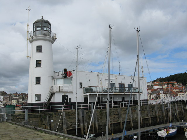
Lighthouse, Vincent's Pier, Scarborough
The lighthouse in this location was destroyed by the German bombardment on 16th December 1914. It was rebuilt by the Scarborough Townsmen's Association by public subscription and opened on the 23rd September 1931 by the mayoress of Scarborough. Mrs J. W. Butler. It is a Grade II Listed Building. Link
 Map © Crown Copyright")
TIP: Click the map for more Large scale mapping
- Grid Square
- TA0488, 1954 images (more nearby 🔍)
- Photographer
- G Laird (more nearby)
- Date Taken
- Wednesday, 6 September, 2017 (more nearby)
- Submitted
- Thursday, 7 September, 2017
- Subject Location
-
OSGB36:
 TA 0492 8856 [10m precision]
WGS84: 54:16.9151N 0:23.3972W - Camera Location
-
OSGB36: TA 0494 8853
- View Direction
- Northwest (about 315 degrees)