2017
NY1114 : Flooded path beside Ennerdale Water
taken 7 years ago, 4 km SE of Croasdale, Cumbria, England
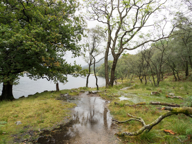
Flooded path beside Ennerdale Water
The path, which is part of the Wainwright Coast to Coast route, at the time of use was flooded for long stretches following heavy rain. (Note: the path for some distance is at, or very close to the lake shore but a public footpath - a right of way - is shown on OS maps a short distance away from and above the shore.)
 Map © Crown Copyright")
TIP: Click the map for more Large scale mapping
- Grid Square
- NY1114, 36 images (more nearby 🔍)
- Photographer
- Trevor Littlewood (more nearby)
- Date Taken
- Tuesday, 5 September, 2017 (more nearby)
- Submitted
- Friday, 8 September, 2017
- Subject Location
-
OSGB36:
 NY 1199 1401 [10m precision]
WGS84: 54:30.8233N 3:21.6572W - Camera Location
-
OSGB36: NY 1197 1402
- View Direction
- Southeast (about 135 degrees)