2017
SK4930 : Ratcliffe-on-Soar Power Station from afar
taken 7 years ago, near to Ratcliffe on Soar, Nottinghamshire, England
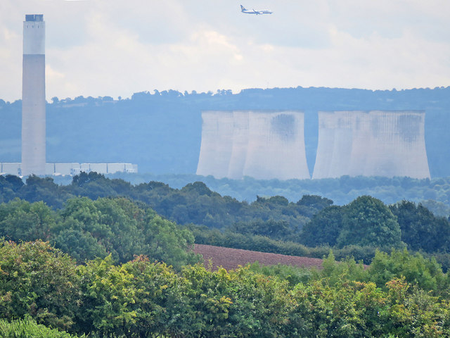
Ratcliffe-on-Soar Power Station from afar
A long telephoto view into the blue distance from the Strelley to Swingate bridle path, about 8 miles (13km) north. Stapleford, Toton and the Trent Valley are hidden. I hadn't noticed the Ryanair plane making for East Midlands Airport when I framed the picture. SK5043 : Between Swingate and Strelley shows the spot the picture was taken from.
 Map © Crown Copyright")
TIP: Click the map for more Large scale mapping
- Grid Square
- SK4930, 115 images (more nearby 🔍)
- Photographer
- John Sutton (more nearby)
- Date Taken
- Friday, 8 September, 2017 (more nearby)
- Submitted
- Sunday, 10 September, 2017
- Subject Location
-
OSGB36:
 SK 4989 3025 [10m precision]
WGS84: 52:52.0455N 1:15.6196W - Camera Location
-
OSGB36: SK 5022 4316
- View Direction
- SOUTH (about 180 degrees)