2007
NH2038 : Meall Innis an Loichel
taken 17 years ago, near to Meall Innis an Loichel [hill or Mountain], Highland, Great Britain
This is 1 of 3 images, with title Meall Innis an Loichel in this square
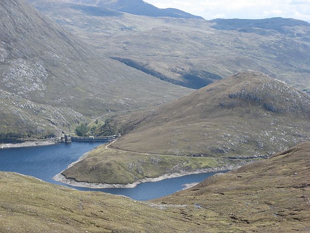
Meall Innis an Loichel
An unusual conical hill inside Glen Strathfarrar. The raising of Loch Monar has involved building a dam on either side of the hill.
 Map © Crown Copyright")
TIP: Click the map for more Large scale mapping
- Grid Square
- NH2038, 16 images (more nearby 🔍)
- Photographer
- Richard Webb (more nearby)
- Date Taken
- Saturday, 26 May, 2007 (more nearby)
- Submitted
- Wednesday, 12 September, 2007
- Subject Location
-
OSGB36:
 NH 202 389 [100m precision]
WGS84: 57:24.2912N 4:59.6086W - Camera Location
-
OSGB36: NH 181 389
- View Direction
- EAST (about 90 degrees)