2017
NJ7900 : Drum Castle
taken 7 years ago, near to Hardgate, Aberdeenshire, Scotland
This is 1 of 32 images, with title Drum Castle in this square
Drum Castle
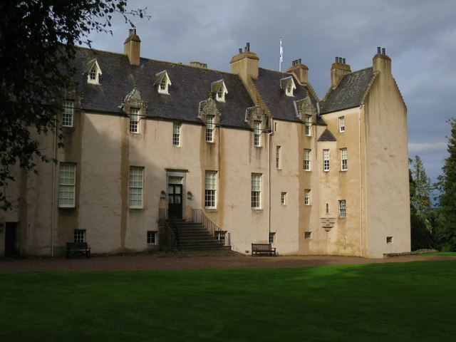
This is the south elevation of the castle, whicch is the most recent part.
Drum Castle
Category A listed the 70ft tower was completed late in the 13th century possibly by Richard Cementarius. The 9th Laird added a wing in 1619 with substantial additions designed by David Bryce in 1876. Robert the Bruce granted the Barony of Drum and estate to William de Irwyn in about 1323 to oversee the Royal Forest of Drum of which 117 acres remain. Now in the care of the National Trust for Scotland the estate remained in the hands of Clan Irvine until 1975 but financial problems led to loss of much of the estate in 1736.
 Map © Crown Copyright")
TIP: Click the map for more Large scale mapping
- Grid Square
- NJ7900, 147 images (more nearby 🔍)
- Photographer
- Anne Burgess (more nearby)
- Date Taken
- Friday, 8 September, 2017 (more nearby)
- Submitted
- Monday, 11 September, 2017
- Subject Location
-
OSGB36:
 NJ 7962 0048 [10m precision]
WGS84: 57:5.6909N 2:20.2779W - Camera Location
-
OSGB36: NJ 7960 0047
- View Direction
- East-northeast (about 67 degrees)