2015
SX5688 : Dartmoor Hillside
taken 9 years ago, 4 km ESE of Sourton, Devon, England
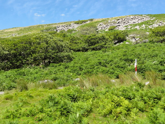
Dartmoor Hillside
Looking up the eastern side of the valley of the West Okement River. The woodland is the southeastern end of Black-a-Tor Copse. The red and white pole is one of the range markers planted on the edge of the Dartmoor military firing areas to warn walkers not to enter on days when firing is taking place. On firing days red flags are also flown on hilltops.
 Map © Crown Copyright")
TIP: Click the map for more Large scale mapping
- Grid Square
- SX5688, 28 images (more nearby 🔍)
- Photographer
- Tony Atkin (more nearby)
- Date Taken
- Sunday, 2 August, 2015 (more nearby)
- Submitted
- Wednesday, 13 September, 2017
- Subject Location
-
OSGB36:
 SX 5689 8884 [10m precision]
WGS84: 50:40.8943N 4:1.6224W - Camera Location
-
OSGB36: SX 5689 8861
- View Direction
- NORTH (about 0 degrees)