NS9554 : The gates to Wilsontown
taken 7 years ago, near to Rootpark, South Lanarkshire, Scotland
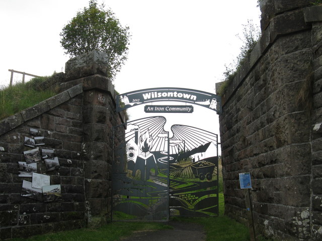
Robert Wilson, the owner of a small coal mine in the 1770s, discovered ironstone in a burn at what became Wilsontown in Lanarkshire [now South Lanarkshire]. With two brothers they set up an ironworks to exploit the find. Although not a financial success - bankrupt in 1811, sold in 1821 to William Dixon, and finally closing in 1842 it was the first ironworks in Lanarkshire, which went on to dominate the Scottish iron and steel industry. Roads and railways were built; ironstone was dug from bell-pits over a large area of land; blast furnaces, coke ovens, rolling mills, forge, engine house, calcining kilns, company offices and store, and houses were built. At its peak Wilsontown had a population of about 2000 living in poor conditions no running water, outside closets, noise and dust from the works which they surrounded lose your job, lose your house. After closure in 1842 the houses remained, and some were lived in until the 1930s. In the 1960s, when virtually all of the vestiges of the town and works were bulldozed to make way for forestry, so little remains. The forestry in the area has now been cleared and the Forestry Commission has produced an excellent information leaflet to guide people around the way-marked paths that have been created, with seats and information boards, both around the area of the works and housing [they were cheek-by-jowl] and the adjacent woodland that is the site of the big house of the Wilsons, now demolished. The site is now a Historic Environment Scotland Scheduled Monument Link
. For a video see Link
 Map © Crown Copyright")
- Grid Square
- NS9554, 35 images (more nearby 🔍)
- Photographer
- M J Richardson (more nearby)
- Date Taken
- Friday, 15 September, 2017 (more nearby)
- Submitted
- Monday, 18 September, 2017
- Subject Location
-
OSGB36:
 NS 9513 5483 [10m precision]
WGS84: 55:46.5233N 3:40.4040W - Camera Location
-
OSGB36: NS 9514 5482
- View Direction
- North-northwest (about 337 degrees)