2017
TQ2983 : View of the Francis Crick Institute and BT Tower from the top of the Victorian Waterpoint
taken 7 years ago, near to Camden Town, Camden, England
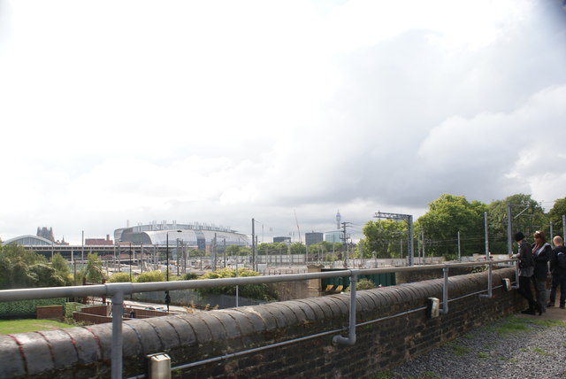
View of the Francis Crick Institute and BT Tower from the top of the Victorian Waterpoint
The Victorian Waterpoint was open to the public as part of Open House Weekend 2017. Looking south-southwest.
 Map © Crown Copyright")
TIP: Click the map for more Large scale mapping
- Grid Square
- TQ2983, 1237 images (more nearby 🔍)
- Photographer
- Robert Lamb (more nearby)
- Date Taken
- Sunday, 17 September, 2017 (more nearby)
- Submitted
- Monday, 18 September, 2017
- Subject Location
-
OSGB36:
 TQ 2992 8307 [10m precision]
WGS84: 51:31.8959N 0:7.7025W - Camera Location
-
OSGB36: TQ 2995 8351
- View Direction
- SOUTH (about 180 degrees)