TL4459 : Panorama of Jesus Green
taken 7 years ago, near to Cambridge, Cambridgeshire, England
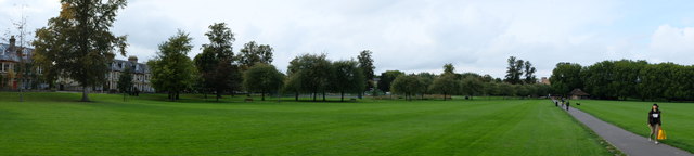
Jesus Green is a park in the north of central Cambridge. It is located north of Jesus College, hence the name. Jesus Ditch runs through Jesus Green. On the northern edge of Jesus Green is the River Cam, with Chesterton Road (the A1303) on the opposite side. To the east is Victoria Avenue. Jesus Green was separated from Midsummer Common in 1890 when Victoria Avenue was built. Jesus Green has since become a park and is no longer maintained in a state suitable for grazing.
The Jesus Green Swimming Pool is a lido on the northern edge of Jesus Green next to the River Cam. It is one of the few remaining examples of the lidos built across the country in the 1920s. It is among the longest outdoor swimming pools in Europe at 100 yards (91 m) in length.
Close by on the River Cam is Jesus Lock. The stretch north (downstream) of Jesus Lock is sometimes called the lower river. The stretch between Jesus Lock and Baits Bite Lock is much used for rowing. There are also many residential boats on this stretch, their occupants forming a community who call themselves the Camboaters. The stretch above Jesus Lock is sometimes known as the middle river. Access for mechanically powered boats is prohibited above 'La Mimosa' public house (at the upstream end of Jesus Green) between 1 April and 30 September, when the middle (and upper) river are open only to manually propelled craft, many traditional flat-bottomed punts.
In 2001, the Cambridge Beer Festival moved to Jesus Green. It has been held each May ever since.
 Map © Crown Copyright")
- Grid Square
- TL4459, 1456 images (more nearby 🔍)
- Photographer
- Bob Harvey (more nearby)
- Date Taken
- Monday, 18 September, 2017 (more nearby)
- Submitted
- Tuesday, 19 September, 2017
- Subject Location
-
OSGB36:
 TL 4495 5913 [10m precision]
WGS84: 52:12.6798N 0:7.2037E - Camera Location
-
OSGB36: TL 4500 5909
- View Direction
- Northwest (about 315 degrees)