2017
NY1222 : On Darling Fell
taken 7 years ago, near to Loweswater, Cumbria, England
This is 1 of 3 images, with title On Darling Fell in this square
On Darling Fell
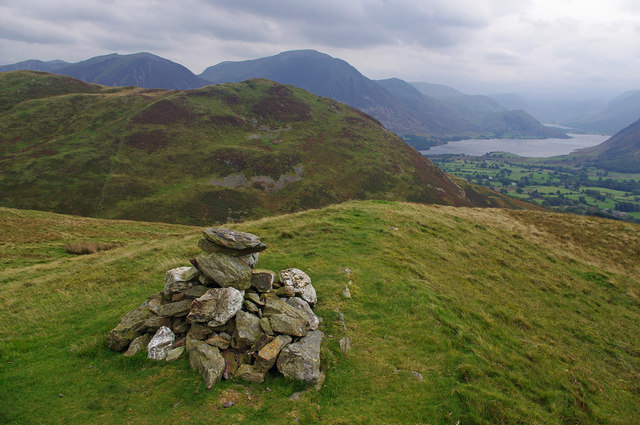
The SW top of Loweswater Fell, looking towards the SE top (south end of Low Fell). Crummock Water is on the right, with a glimpse of Buttermere beyond. Other visible fells include Whiteside (left), Grasmoor, Whiteless Pike, Robinson and Rannerdale Knotts (right, low).
 Map © Crown Copyright")
TIP: Click the map for more Large scale mapping
- Grid Square
- NY1222, 43 images (more nearby 🔍)
- Photographer
- Ian Taylor (more nearby)
- Date Taken
- Sunday, 24 September, 2017 (more nearby)
- Submitted
- Saturday, 30 September, 2017
- Subject Location
-
OSGB36:
 NY 1296 2249 [10m precision]
WGS84: 54:35.4046N 3:20.9092W - Camera Location
-
OSGB36: NY 1295 2250
- View Direction
- East-southeast (about 112 degrees)