2017

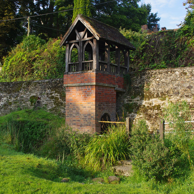
TR1640 : St Ethelburga's Well, Lyminge

taken 7 years ago, near to Lyminge, Kent, England

St Ethelburga's Well, Lyminge
Grade II Listed Building - see LinkExternal link

Creative Commons Licence [Some Rights Reserved]   © Copyright Ian Taylor and licensed for reuse under this Creative Commons Licence.
Geographical Context: Historic sites and artefacts Water resources Primary Subject: Well other tags: Grade II Listed Building Click a tag, to view other nearby images.
This photo is linked from: Automatic Clusters: · Grade I Listed Building [3] ·
1:50,000 Modern Day Landranger(TM) Map © Crown Copyright
+
+
1:50,000 Modern Day Landranger(TM) Map © Crown Copyright
TIP: Click the map for more Large scale mapping
Grid Square
TR1640, 103 images   (more nearby 🔍)
Photographer
Ian Taylor   (more nearby)
Date Taken
Thursday, 7 September, 2017   (more nearby)
Submitted
Tuesday, 3 October, 2017
Subject Location
OSGB36: geotagged! TR 1617 4089 [10m precision]
WGS84: 51:7.5889N 1:5.2759E
Camera Location
OSGB36: geotagged! TR 1619 4090
View Direction
Southwest (about 225 degrees)
Clickable map
+
NW N NE
W Go E
SW S SE
Image Type (about): geograph 
This page has been viewed about 51 times
You are not logged in login | register