2007
NX9618 : North Pier Whitehaven
taken 17 years ago, near to Whitehaven, Cumbria, England
This is 1 of 2 images, with title starting with North Pier in this square
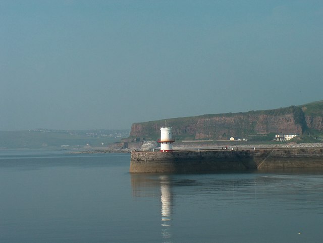
North Pier Whitehaven.
Redness Point and Bransty Cliffs are in the background. " Whitey Rock " can be seen squeezed between North Pier Lighthouse and the Point. The white buildings on the extreme right at the foot of the cliffs are on the site of the now demolished William Pit headworks.
 Map © Crown Copyright")
TIP: Click the map for more Large scale mapping
- Grid Square
- NX9618, 162 images (more nearby 🔍)
- Photographer
- Harold Potts (more nearby)
- Date Taken
- Monday, 11 June, 2007 (more nearby)
- Submitted
- Saturday, 15 September, 2007
- Subject Location
-
OSGB36:
 NX 969 186 [100m precision]
WGS84: 54:33.1592N 3:35.7068W - Camera Location
-
OSGB36: NX 967 184
- View Direction
- Northeast (about 45 degrees)