2017
TF8343 : Sea defence east of Burnham Norton
taken 7 years ago, near to Burnham Norton, Norfolk, England
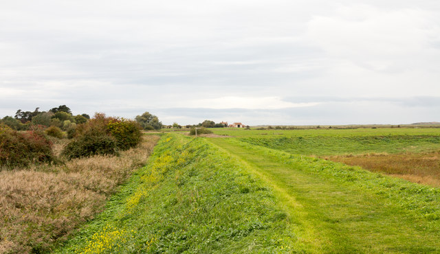
Sea defence east of Burnham Norton
The grassed, sea defence embankment makes a turn to the right just ahead in the image but also branches to go ahead towards the distant buildings. The path is also the route of two named trails, Peddars Way and the Norfolk Coast Path.
 Map © Crown Copyright")
TIP: Click the map for more Large scale mapping
- Grid Square
- TF8343, 101 images (more nearby 🔍)
- Photographer
- Trevor Littlewood (more nearby)
- Date Taken
- Saturday, 7 October, 2017 (more nearby)
- Submitted
- Thursday, 12 October, 2017
- Subject Location
-
OSGB36:
 TF 8342 4393 [10m precision]
WGS84: 52:57.6819N 0:43.7656E - Camera Location
-
OSGB36: TF 8345 4392
- View Direction
- West-northwest (about 292 degrees)