2017
NX0660 : Baptist Church, Stranraer - October 2017
taken 7 years ago, near to Stranraer, Dumfries And Galloway, Scotland
This is 1 of 8 images, with title starting with Baptist Church in this square
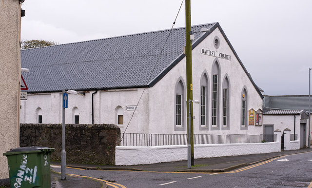
Baptist Church, Stranraer - October 2017
Situated on the corner of Bellevilla Street and Thistle Street, the 1908 OS Map shows this site as a "drill hall". It is not currently clear when the site became the Baptist Church.
 Map © Crown Copyright")
TIP: Click the map for more Large scale mapping
- Grid Square
- NX0660, 3077 images (more nearby 🔍)
- Photographer
- The Carlisle Kid (more nearby)
- Date Taken
- Saturday, 14 October, 2017 (more nearby)
- Submitted
- Tuesday, 17 October, 2017
- Subject Location
-
OSGB36:
 NX 063 608 [100m precision]
WGS84: 54:54.2607N 5:1.3670W - Camera Location
-
OSGB36: NX 063 607
- View Direction
- Northwest (about 315 degrees)