2017
NH6159 : A black river on the Black Isle
taken 7 years ago, near to Culbokie, Highland, Scotland
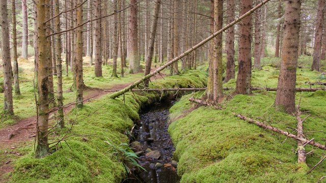
A black river on the Black Isle
Findon Burn has a bed of black rocks. A good path follows its course through Culbokie Wood. For more information on Culbokie Wood and for a map of paths visit Link . The path is not seen on any OS maps.
 Map © Crown Copyright")
TIP: Click the map for more Large scale mapping
- Grid Square
- NH6159, 81 images (more nearby 🔍)
- Photographer
- Julian Paren (more nearby)
- Date Taken
- Thursday, 19 October, 2017 (more nearby)
- Submitted
- Thursday, 19 October, 2017
- Subject Location
-
OSGB36:
 NH 6133 5925 [10m precision]
WGS84: 57:36.1129N 4:19.3297W - Camera Location
-
OSGB36: NH 61315 59237
- View Direction
- East-northeast (about 67 degrees)