2017
SJ8491 : Sign
taken 6 years ago, near to Didsbury, Manchester, England
Sign
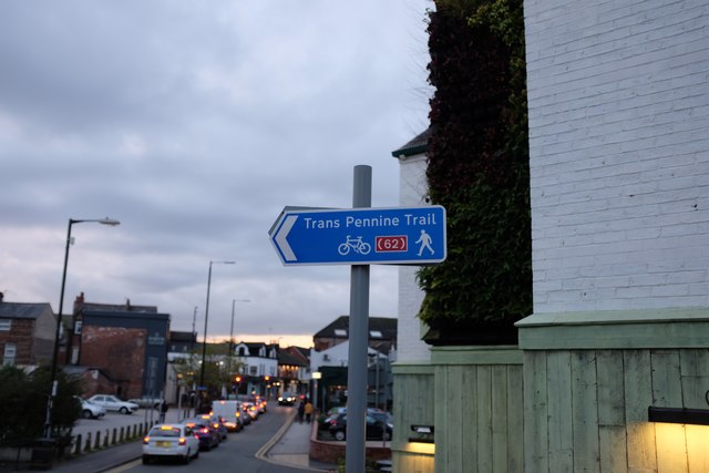
Sign for the Trans Pennine Trail, a coast-to-coast route from Southport to Hornsea
Trans-Pennine Trail
The Trans Pennine Trail is a long-distance path running from coast to coast across Northern England entirely on surfaced paths and using only gentle gradients (it runs largely along disused railway lines and canal towpaths). It forms part of European walking route E8 and is part of the National Cycle Network.
The surface and gradients make it a relatively easy trail, suitable for cyclists, pushchairs and wheelchair users. Some parts are also open to horse riding.
The trail Starts at Southport and ends at Hornsea a distance of 207 miles.
 Map © Crown Copyright")
TIP: Click the map for more Large scale mapping
- Grid Square
- SJ8491, 210 images (more nearby 🔍)
- Photographer
- Bob Harvey (more nearby)
- Date Taken
- Wednesday, 25 October, 2017 (more nearby)
- Submitted
- Wednesday, 25 October, 2017
- Subject Location
-
OSGB36:
 SJ 8479 9121 [10m precision]
WGS84: 53:25.0482N 2:13.8188W - Camera Location
-
OSGB36: SJ 8479 9121
- View Direction
- WEST (about 270 degrees)