2017
NH9030 : Ground descending towards Coire Odhar Mòr
taken 6 years ago, near to Coire Odhar Mòr [other Features], Highland, Great Britain
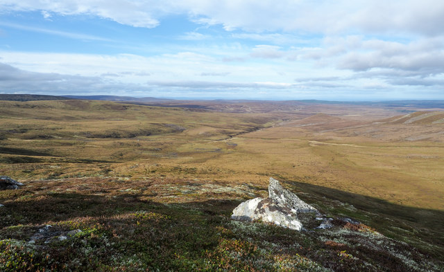
Ground descending towards Coire Odhar Mòr
The foreground rock is part of a rib descending from the highest point of Cnapan a' Choire Odhair Bhig; it soon loses its identity, merging with the general slope on the way down to the shallow feature, Coire Odhar Mòr.
 Map © Crown Copyright")
TIP: Click the map for more Large scale mapping
- Grid Square
- NH9030, 2 images (more nearby 🔍)
- Photographer
- Trevor Littlewood (more nearby)
- Date Taken
- Friday, 27 October, 2017 (more nearby)
- Submitted
- Wednesday, 1 November, 2017
- Subject Location
-
OSGB36:
 NH 9040 3023 [10m precision]
WGS84: 57:20.9605N 3:49.3799W - Camera Location
-
OSGB36: NH 9048 3001
- View Direction
- North-northwest (about 337 degrees)