2005
SJ9362 : The Knot Inn
taken 19 years ago, near to Rushton Spencer, Staffordshire, England
This is 1 of 2 images, with title The Knot Inn in this square
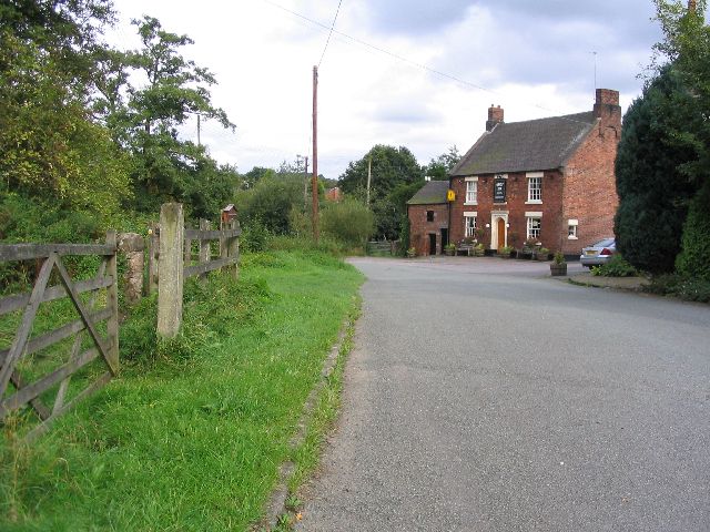
The Knot Inn
This picture was taken from SJ935624, where the Staffordshire way cross the road, looking NE towards the A523. The Pub that can be seen to the right is the Knot Inn. Prior to the railway being re-used as the Staffordshire way this was the site of the station.
 Map © Crown Copyright")
TIP: Click the map for more Large scale mapping
- Grid Square
- SJ9362, 39 images (more nearby 🔍)
- Photographer
- Dave Smethurst (more nearby)
- Date Taken
- Saturday, 17 September, 2005 (more nearby)
- Submitted
- Tuesday, 20 September, 2005
- Subject Location
-
OSGB36:
 SJ 935 624 [100m precision]
WGS84: 53:9.5212N 2:5.9199W - Camera Location
-
OSGB36: SJ 935 624