2017
NZ1456 : Path through the woods
taken 6 years ago, near to Burnopfield, County Durham, England
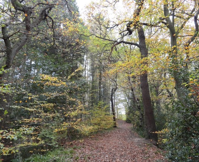
Path through the woods
This is the section of Pontburn Woods south of the B6310, showing the trees in autumn colours. One of the last remaining deciduous woods in this part of County Durham, which was why the Woodland Trust bought it.
 Map © Crown Copyright")
TIP: Click the map for more Large scale mapping
- Grid Square
- NZ1456, 84 images (more nearby 🔍)
- Photographer
- Robert Graham (more nearby)
- Date Taken
- Wednesday, 1 November, 2017 (more nearby)
- Submitted
- Friday, 10 November, 2017
- Subject Location
-
OSGB36:
 NZ 1469 5608 [10m precision]
WGS84: 54:53.9541N 1:46.3479W - Camera Location
-
OSGB36: NZ 1468 5611
- View Direction
- South-southeast (about 157 degrees)