2017
SJ9621 : River Sow flood plain south-east of Stafford
taken 7 years ago, near to Milford, Staffordshire, England
This is 1 of 5 images, with title River Sow flood plain south-east of Stafford in this square
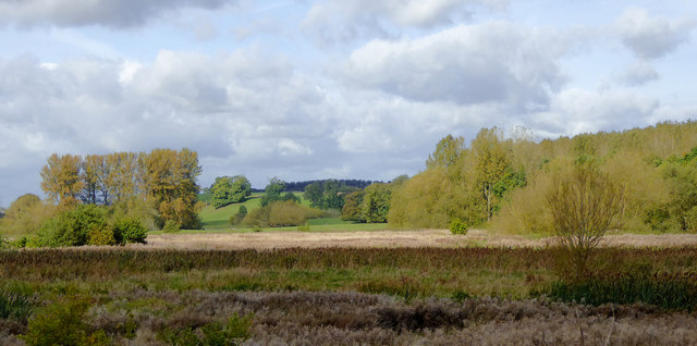
River Sow flood plain south-east of Stafford
An image looking from the Staffordshire and Worcestershire Canal in the direction of Stafford. This land is very marshy in winter, and is regularly flooded following heavy rain. The river flows from left to right towards the River Trent about two miles north-north-east. This rough pasture is grazed on occasionally in summer, but is often waterlogged or flooded at other times of the year.
 Map © Crown Copyright")
TIP: Click the map for more Large scale mapping
- Grid Square
- SJ9621, 188 images (more nearby 🔍)
- Photographer
- Roger D Kidd (more nearby)
- Date Taken
- Friday, 6 October, 2017 (more nearby)
- Submitted
- Saturday, 18 November, 2017
- Subject Location
-
OSGB36:
 SJ 9681 2154 [10m precision]
WGS84: 52:47.4851N 2:2.9247W - Camera Location
-
OSGB36: SJ 9703 2139
- View Direction
- Northwest (about 315 degrees)