2017
SJ5988 : Sankey Canal, Sankey Valley Park
taken 6 years ago, near to Great Sankey, Warrington, England
This is 1 of 4 images, with title starting with Sankey in this square
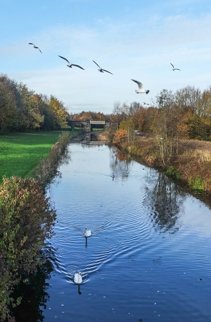
Sankey Canal, Sankey Valley Park
The bridge in the distance is one of the railway lines between Manchester and Liverpool.
The Sankey Canal, which is also known as the Sankey Brook Navigation and the St Helens Canal, historically entirely within Lancashire is a canal now in Cheshire, extending into Merseyside, in the northwest of England, connecting St Helens with the River Mersey at Spike Island. When opened in 1757, it ran along the valley of the Sankey Brook from the point where the brook joined the Mersey, past Warrington to Parr at the north east of what became St Helens town centre. Extensions were constructed at the Mersey end of the canal, firstly to Fiddlers Ferry and then to Widnes, while at the northern end, it was extended into Sutton, close to what became the centre of St Helens. The canal was gradually abandoned between 1931 and 1963, but has been the object of a restoration attempt since 1985, when the Sankey Canal Restoration Society was formed.
Restoration of the canal began in 1980, when work began on the section between Bewsey and Liverpool Road, Great Sankey, funded by a Derelict Land Grant. Most of the canal is still in water and much has been restored to navigable standard, with short sections at Fiddlers Ferry, Warrington and Spike Island, Widnes having locks into the Mersey which have allowed craft access to the canal for mooring since the locks were restored in the 1980s. However, fixed bridges which replaced the original wooden swing bridges and other obstructions isolate the sections from one another. The route of the canal passes through the Sankey Valley Park and the towpath from Sankey Bridges to Widnes now forms part of the Trans Pennine Trail.
There are plans to restore the canal, and to extend it to join the main canal system via the Leeds and Liverpool Canal. The total cost of this would be in excess of £100m and it is therefore a long-term project. There are, however, plans to dig out an infilled section in the centre of St Helens as part of the town's Eastside development. A feasibility study for this work was funded by a grant from the Single Regeneration Budget Fund, while at the other end of the canal, the Widnes Waterfront plan, published by Halton Council, and the proposed new Mersey crossing between Widnes and Runcorn are expected to lead to further restoration at Widnes.
The section of the Sankey Canal running from St Helens to Newton le Willows is expected to be the most difficult to restore, and is likely to involve the laying of a complete new canal bed.
 Map © Crown Copyright")
TIP: Click the map for more Large scale mapping
- Grid Square
- SJ5988, 73 images (more nearby 🔍)
- Photographer
- Matt Harrop (more nearby)
- Date Taken
- Sunday, 19 November, 2017 (more nearby)
- Submitted
- Sunday, 19 November, 2017
- Subject Location
-
OSGB36:
 SJ 5904 8884 [10m precision]
WGS84: 53:23.6876N 2:37.0453W - Camera Location
-
OSGB36: SJ 5907 8879
- View Direction
- North-northwest (about 337 degrees)