2017
TL6944 : Sturmer gauging station
taken 6 years ago, near to Sturmer, Essex, England
This is 1 of 2 images, with title Sturmer gauging station in this square
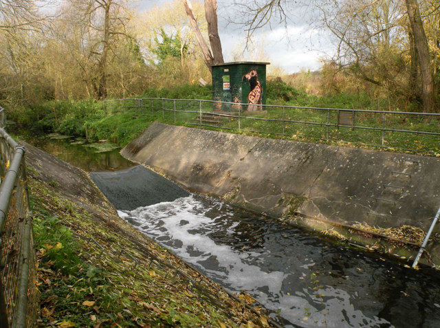
Sturmer gauging station
"Measuring water levels to manage flood risk and water resources" according to a notice which gives its position as TL 64640 44098, a mere 5km out.
 Map © Crown Copyright")
TIP: Click the map for more Large scale mapping
- Grid Square
- TL6944, 37 images (more nearby 🔍)
- Photographer
- Keith Edkins (more nearby)
- Date Taken
- Wednesday, 22 November, 2017 (more nearby)
- Submitted
- Wednesday, 22 November, 2017
- Subject Location
-
OSGB36:
 TL 6963 4410 [10m precision]
WGS84: 52:4.1575N 0:28.4066E - Camera Location
-
OSGB36: TL 6964 4409
- View Direction
- Northwest (about 315 degrees)