SU8586 : Marlow Bridge
taken 7 years ago, near to Marlow, Buckinghamshire, England
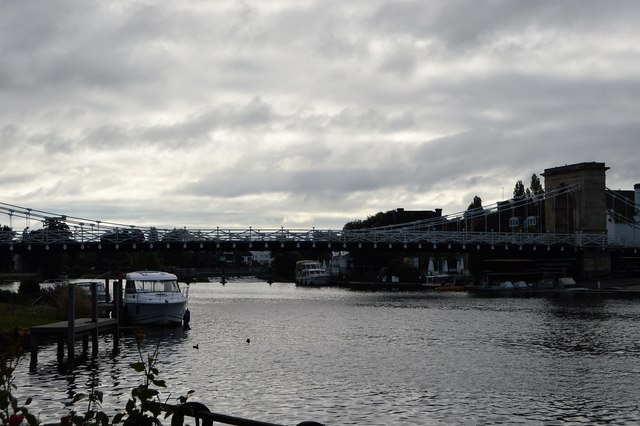
Marlow Bridge is a road traffic and foot bridge over the River Thames between the town of Marlow, Buckinghamshire and the village of Bisham in Berkshire. It crosses the Thames just upstream of Marlow Lock, on the reach to Temple Lock.
The current suspension bridge was designed by William Tierney Clark and was built between 1829 and 1832, replacing a wooden bridge further downstream which collapsed in 1828. It is the only suspension bridge across the non-tidal Thames. The Széchenyi Chain Bridge, spanning the River Danube in Budapest, was also designed by William Clark and it is a larger scale version of Marlow bridge.
In 195657 Marlow Bridge was restored and all of its chains were replaced. It is Grade I listed. Link
The bridge has a 3 tonne weight restriction and is used only by foot and local road traffic. Other traffic is carried by the Marlow By-pass Bridge.
The River Thames rises at Thames Head in Gloucestershire on the slopes of the Cotswolds and flows generally eastward to its mouth near Southend in Essex. At 215 miles long it is one of the longest rivers in Britain, and the longest entirely within England. It is one of the most important rivers in Britain. Link
Grade I listed buildings and structures are of exceptional, even international importance. There are over 6,000 in the country. Only 2.5% of listed buildings are Grade I listed.
In Scotland the classification is Category A
Index: Link
 Map © Crown Copyright")
- Grid Square
- SU8586, 852 images (more nearby 🔍)
- Photographer
- N Chadwick (more nearby)
- Date Taken
- Sunday, 16 July, 2017 (more nearby)
- Submitted
- Thursday, 23 November, 2017
- Subject Location
-
OSGB36:
 SU 8512 8608 [10m precision]
WGS84: 51:34.0308N 0:46.3989W - Camera Location
-
OSGB36: SU 8502 8608
- View Direction
- EAST (about 90 degrees)