2005
SD6393 : Waterside Viaduct, Sedbergh, Cumbria
taken 19 years ago, near to Firbank, Cumbria, England
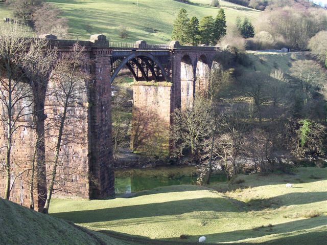
Waterside Viaduct, Sedbergh, Cumbria
This splendid Viaduct is on the disused railway that ran between Clapham Junction (on the Leeds - Morecambe line) and Lowgill on the West Coast Main line. It is 530 ft long and carried the line, closed in 1966, 100 ft above the River Lune. Surprisingly the viaduct is not a listed structure.
 Map © Crown Copyright")
TIP: Click the map for more Large scale mapping
- Grid Square
- SD6393, 92 images (more nearby 🔍)
- Photographer
- Ralph Rawlinson (more nearby)
- Date Taken
- Saturday, 29 January, 2005 (more nearby)
- Submitted
- Wednesday, 21 September, 2005
- Subject Location
-
OSGB36:
 SD 630 930 [100m precision]
WGS84: 54:19.8948N 2:34.1734W - Camera Location
-
OSGB36: SD 631 930
- View Direction
- WEST (about 270 degrees)