2018
SD5580 : The valley of Lupton Beck
taken 6 years ago, near to Lupton, Cumbria, England
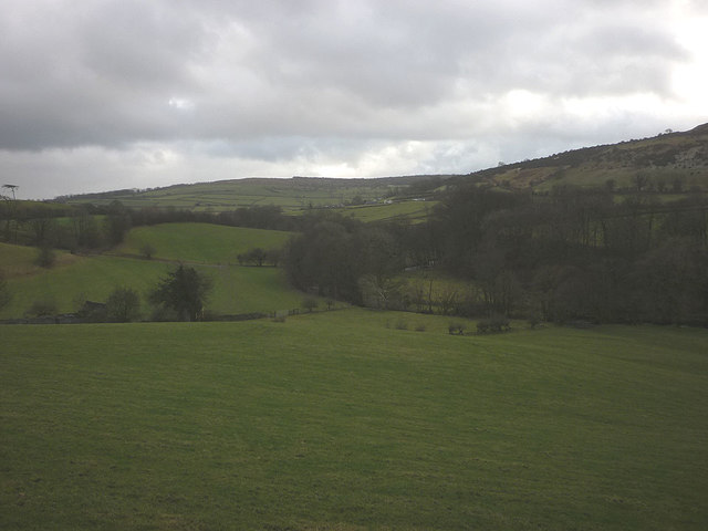
The valley of Lupton Beck
The valley is here a significant defile between the limestone uplands of Farleton Fell/Hutton Roof Crags (seen ahead) and the slaty Scout Hill. The busy A65 cuts through it linking the conurbations of West Yorkshire with the Lake District.
 Map © Crown Copyright")
TIP: Click the map for more Large scale mapping
- Grid Square
- SD5580, 30 images (more nearby 🔍)
- Photographer
- Karl and Ali (more nearby)
- Date Taken
- Wednesday, 17 January, 2018 (more nearby)
- Submitted
- Friday, 19 January, 2018
- Subject Location
-
OSGB36:
 SD 5560 8041 [10m precision]
WGS84: 54:13.0489N 2:40.9433W - Camera Location
-
OSGB36: SD 5529 8095
- View Direction
- South-southeast (about 157 degrees)